projection problems #20546
Comments
|
Author Name: Giovanni Manghi (@gioman) Hi, could you provide a few practical examples attaching sample projects (with sample data) or screenshots/screecasts? thanks.
|
|
Author Name: Kun Zhang (Kun Zhang)
|
|
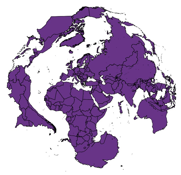
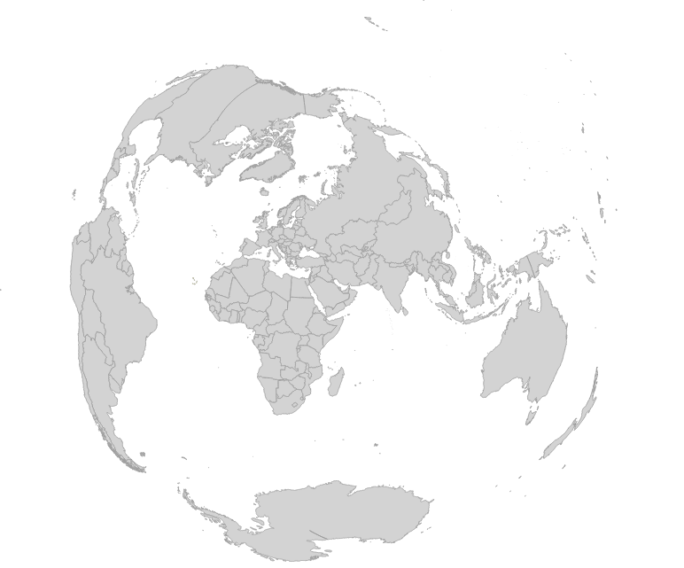
Author Name: Kun Zhang (Kun Zhang) Hi, please look at the picture attached.One is in Mercator projection (EPSG:3857). the world file is 'Admin 0 – Countries' from Natural Earth. Both projection are done in QGIS 2.6.1 thanks for attention.
|
|
Author Name: Raymond Nijssen (@raymondnijssen) You might be using the wrong projection parameters. When I try this one it looks as I expected: +proj=aeqd +lat_0=31 +lon_0=35 +x_0=0 +y_0=0 +a=6371000 +b=6371000 +units=m +no_defs Please try again and let us know if it works. Thanks! According to epsg 3857, this projection only covers latitudes up to about 85 degrees north and south. I guess your data is out of these bounds and not truncated the proper way. I'm using an other world data set and it looks quite ok on my screen.
|
|
Author Name: Giovanni Manghi (@gioman) closing for lack of feedback.
|
Author Name: Kun Zhang (Kun Zhang)
Original Redmine Issue: 12371
Affected QGIS version: 2.8.1
Redmine category:projection_support
hello, I have used QGIS for several years. The software is great.
But I am not very satisfied with map projection, especially for some classical projection.
When I downloaded for example 'Admin 0 – Countries' data from Natural Earth webpage and do some projection, some issues arouse.
Mercator projection for example, in QGIS 1.8.0, Antarctica disappeared;in QGIS 2.2.0 and QGIS 2.6.1, the bottom of Antarctica converge to a point located on the top-left of the screen.
For azimuthal equidistant projection, the pole projection is OK in QGIS 2.6.1, but when I changed the origin to 'lat_0=31, lon_0=35' for example, many polygons overlap.
Hope the projection functionality would be robust in new versions.
The text was updated successfully, but these errors were encountered: