

This project requires django-cms v3.0 or higher to be properly installed and configured.
This package is compatible with Aldryn.


Install
djangocms-gmaps:pip install djangocms-gmaps
Add
djangocms_gmapstoINSTALLED_APPS:INSTALLED_APPS = ( ... 'djangocms_gmaps', ... )Sync database tables (requires south>=1.0.1 if you are using Django 1.6.x):
python manage.py migrate
Add
DJANGOCMS_GMAPS_API_KEYto your project settings:DJANGOCMS_GMAPS_API_KEY = 'AIzaSyCkUOdZ5y7hMm0yrcCQoCvLwzdM6M8s5qk'
For more information about Google Maps API key, please visit https://developers.google.com/maps/documentation/javascript/get-api-key
Plugin(s) Module - If module is None, plugin is grouped Generic group:
DJANGOCMS_GMAPS_PLUGIN_MODULE = _('Generic')
Name of the Map plugin:
DJANGOCMS_GMAPS_PLUGIN_NAME = _('Map')
Name of the Location plugin:
DJANGOCMS_GMAPS_LOCATION_PLUGIN_NAME = _('Location')
Can this plugin only be attached to a placeholder that is attached to a page:
DJANGOCMS_GMAPS_PAGE_ONLY = False
A list of Plugin Class Names. If this is set, this plugin may only be added to plugins listed here:
DJANGOCMS_GMAPS_PARENT_CLASSES = None
Is it required that this plugin is a child of another plugin? Or can it be added to any placeholder:
DJANGOCMS_GMAPS_REQUIRE_PARENT = False
Whether this plugin can be used in text plugins or not:
DJANGOCMS_GMAPS_TEXT_ENABLED = False
Override the Template dropdown choices to have different template options:
DJANGOCMS_GMAPS_TEMPLATES = (
    ('djangocms_gmaps/default.html', _('Default')),
)
You can customize the content and appearance of InfoWindow attached to map markers:
DJANGOCMS_GMAPS_INFOWINDOW_TEMPLATE = 'djangocms_map/infowindow.html'
Set fieldsets to control the layout of Map plugin add/change form:
DJANGOCMS_GMAPS_FIELDSETS = None
Set fieldsets to control the layout of Location plugin add/change form:
DJANGOCMS_GMAPS_LOCATION_FIELDSETS = None
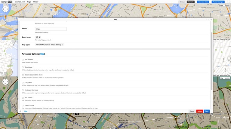
Enable Advanced Options to allow the users to fully customise map controls e.g. streetViewControl:
DJANGOCMS_GMAPS_ADVANCED_OPTIONS_ENABLED = True
Styled maps allow the user to customize the presentation of the Google maps, changing the visual display of such elements as roads, parks, and built-up areas:
DJANGOCMS_GMAPS_STYLED_MAPS_ENABLED = True
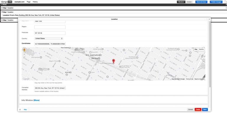
Info windows - set this to false if you want to disable the infowindow:
DJANGOCMS_GMAPS_INFOWINDOW_ENABLED = True
Info window with maxWidth - the maximum width of a info window is set to 220 pixels:
DJANGOCMS_GMAPS_INFOWINDOW_MAXWIDTH = 220
Allow users to define custom marker icons for individual locations instead of the default icons:
DJANGOCMS_GMAPS_CUSTOM_MARKERS_ENABLED = True
- djangocms-disqus - https://github.com/mishbahr/djangocms-disqus
- djangocms-fbcomments - https://github.com/mishbahr/djangocms-fbcomments
- djangocms-forms — https://github.com/mishbahr/djangocms-forms
- djangocms-instagram — https://github.com/mishbahr/djangocms-instagram
- djangocms-responsive-wrapper — https://github.com/mishbahr/djangocms-responsive-wrapper
- djangocms-twitter2 — https://github.com/mishbahr/djangocms-twitter2
- djangocms-youtube — https://github.com/mishbahr/djangocms-youtube